Urban Renewal in Lakeland
Maps and Aerial Images
Edwin Newman named his new subdivision Lakeland and drew up a grand plan for its development. Most of his dream was never realized, but the place did become a community. Over time, the landscape changed and so the city proposed new plans. Included here is Newman’s original Lakeland plan, depictions of the community at various periods, development proposals, and other related maps.
1 to 19 of 19 total items
includes dates: undated - 2015

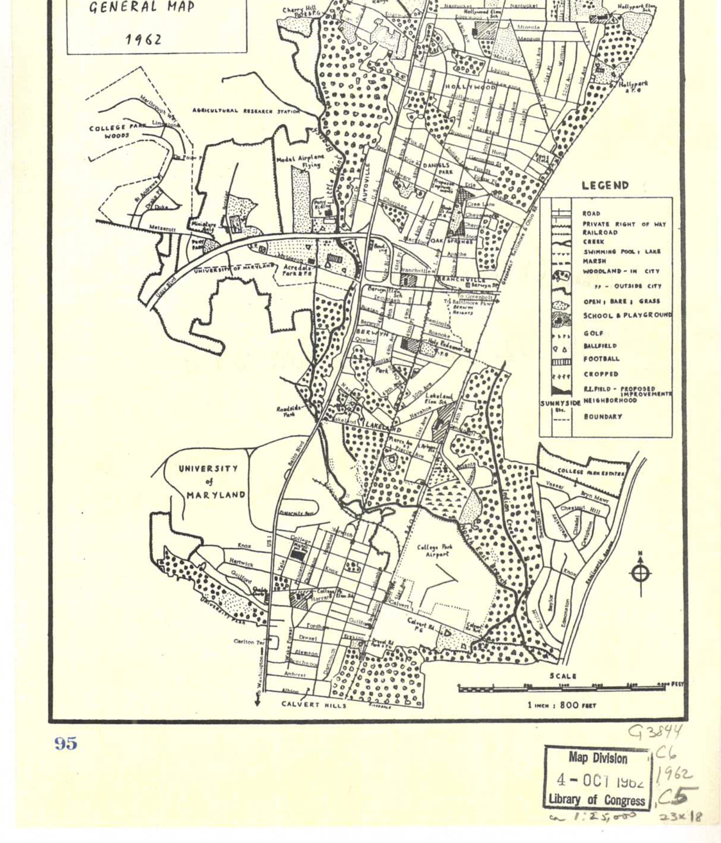
Hopkins Map
1894
Lakeland and Fisheries
1910
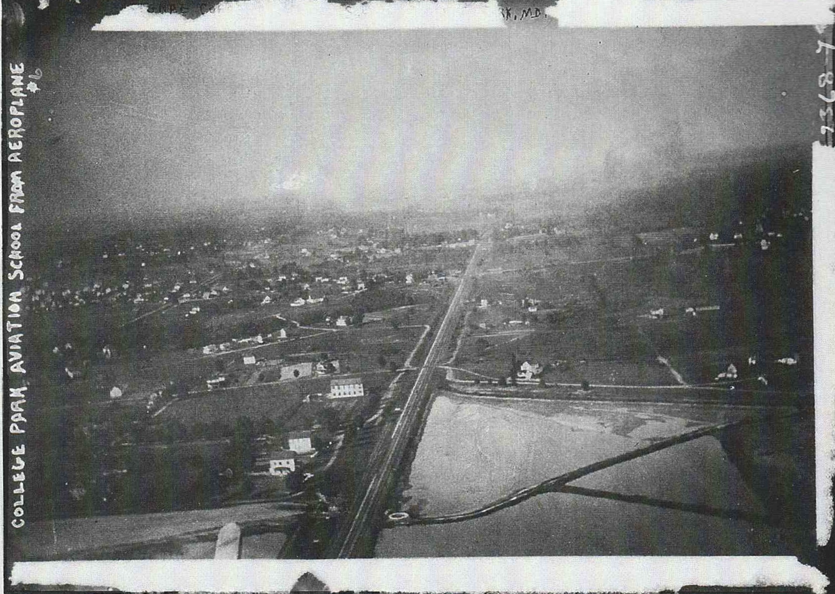
Aerial Photograph of lakes, airport and environs.

Airport and Eastern Lakeland
1911
Hangers and ponds are visible along with portion of Lakeland

Lakeland and Fisheries
1929
Aerial image of lakes, community and surrounding area

Lakeland and Airport
1929
Airport and lakes along with a portion of Lakeland Property of US Army Air Services

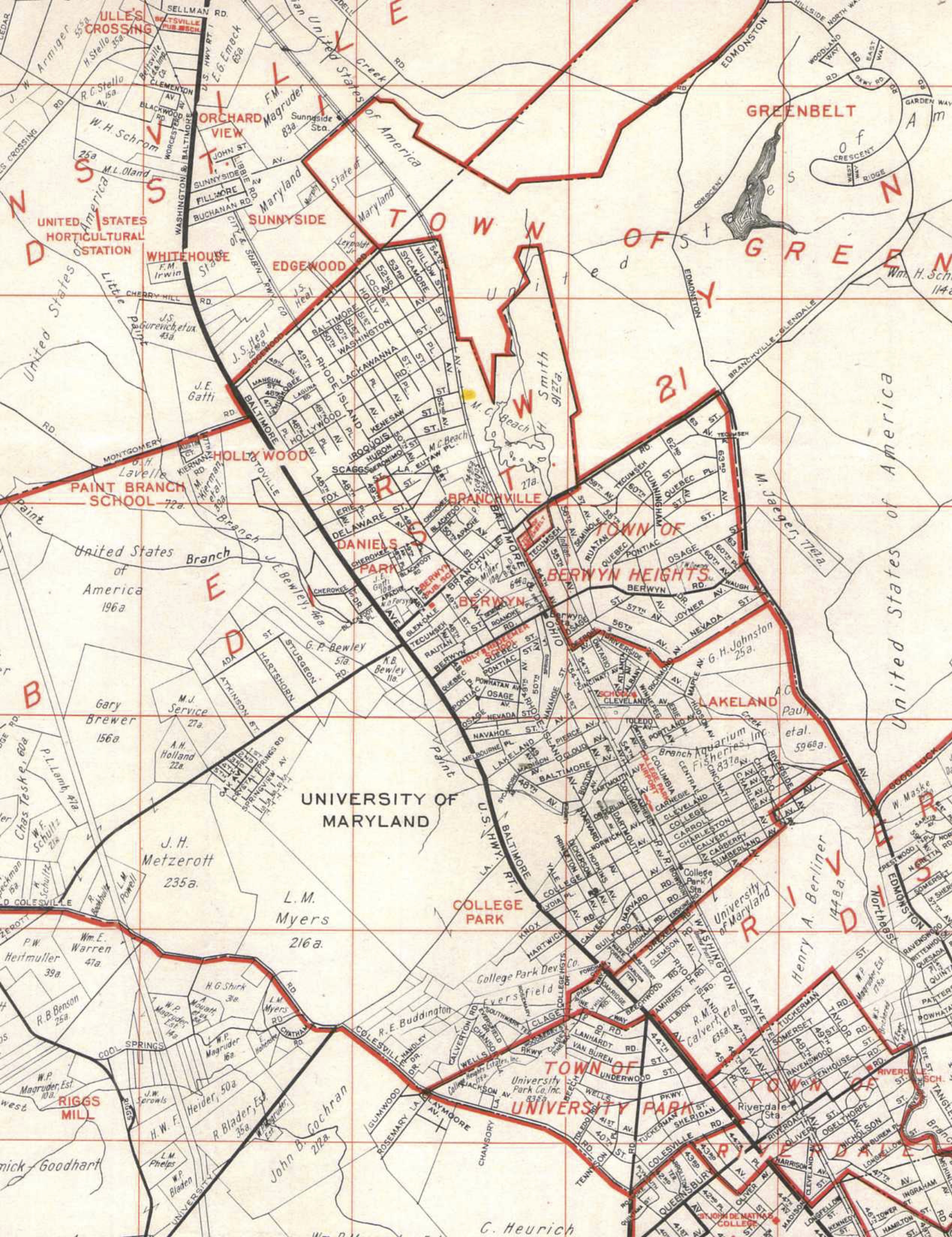
College Park Airport
1931
Airport, College Park, the University of Maryland and part of Lakeland are seen. There is a clear view of the area along the railroad tracks. Property of US Army Air Services
Franklin Survey
1945
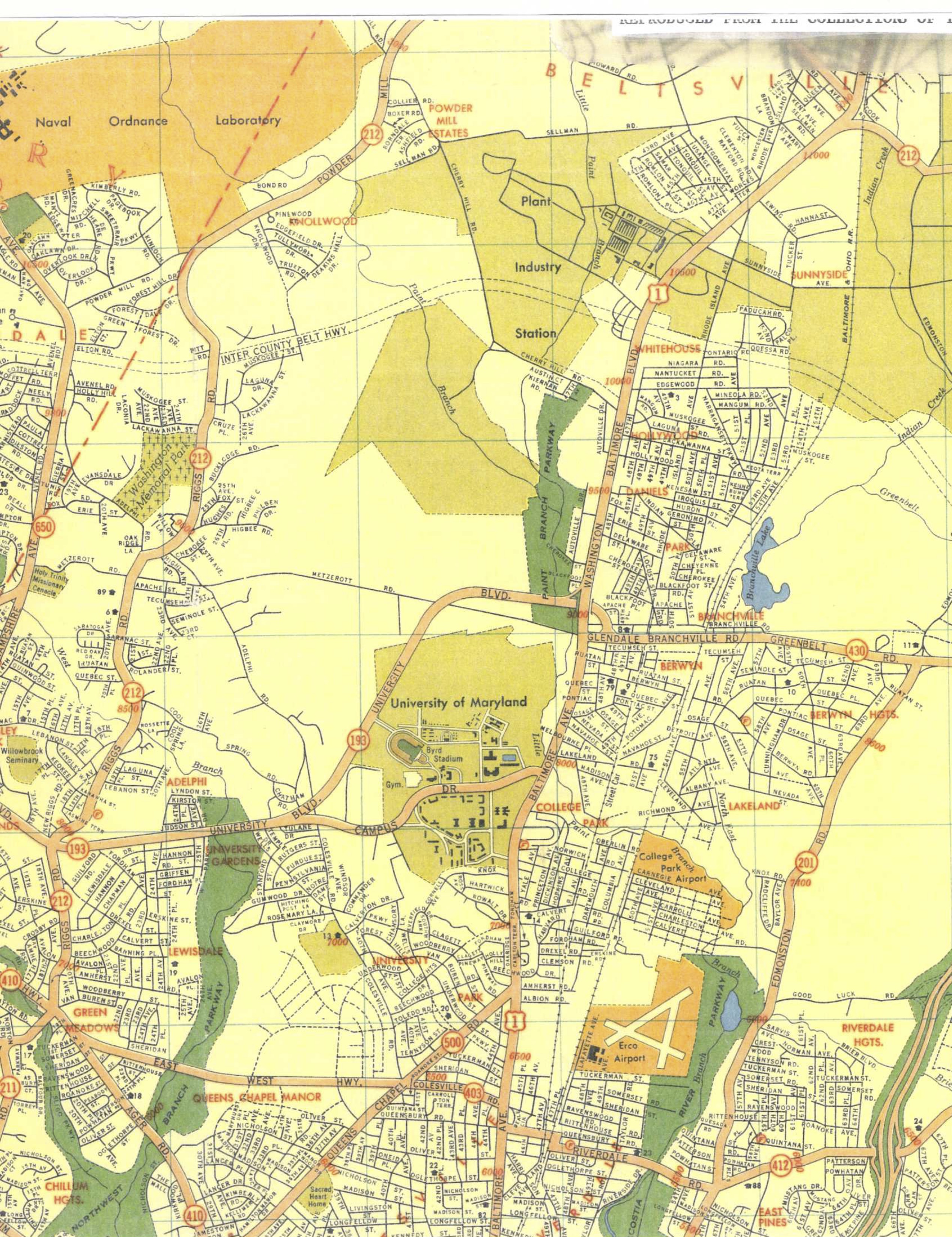
Zoning Map
1956
College Park and area

DC Suburbia Map
1959
Map of DC Suburbia from Baltimore Ave to Rhode Island, 1939-1959
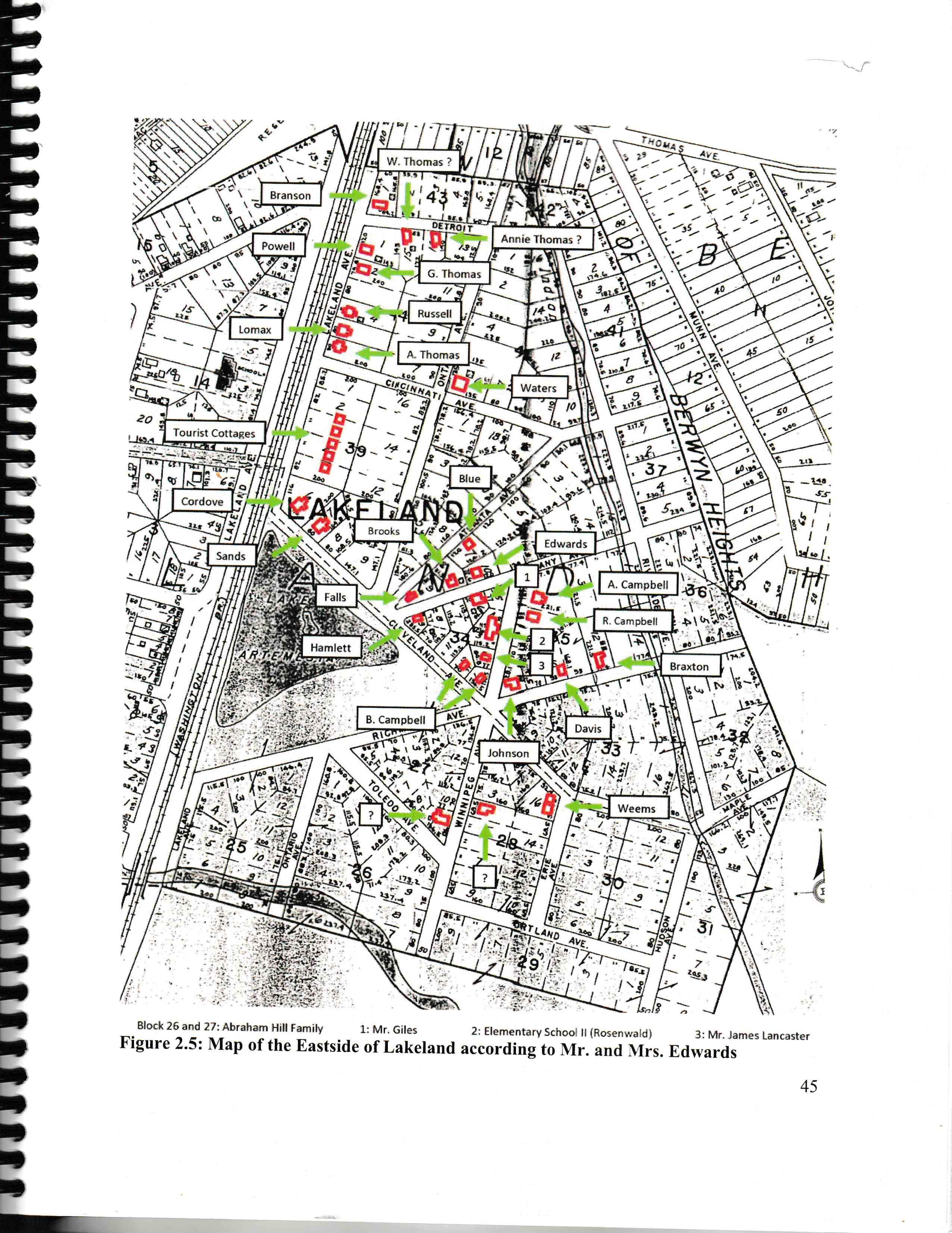
Eastern Lakeland Residents
1960
Map of residences in eastern section of Lakeland based on information from Pearl Lee and James Edwards III Page from eastern Lakeland report

College Park Airport
1965
Airport, industrial area, lake and portion of Lakeland
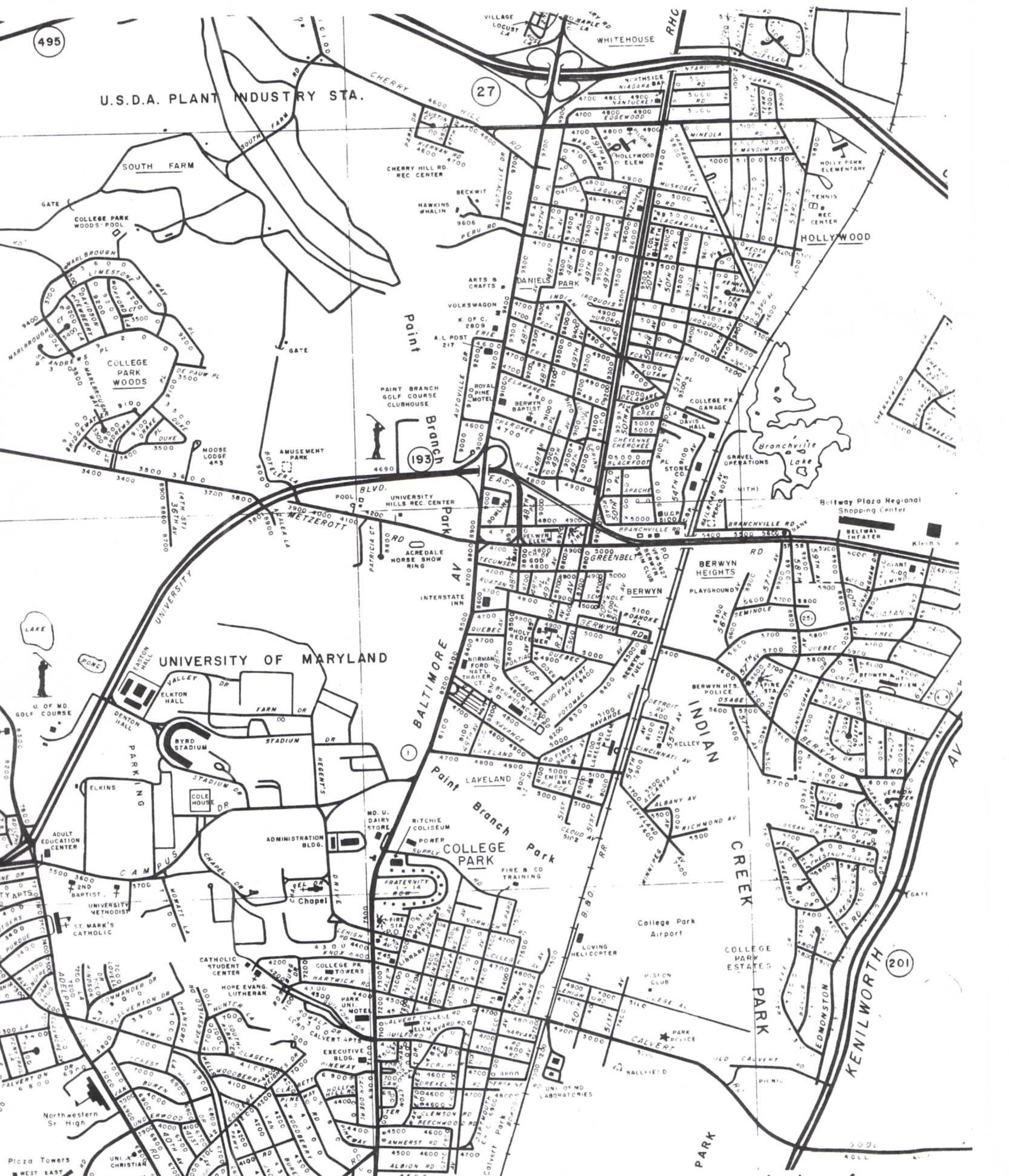
LaBue
1969

Map with Notes
1970
This map shows notations on owners of properties

Lakeland an Urban Design Study
1970
"Lakeland, an Urban Design Sturdy" Commissioned by the City of College Park
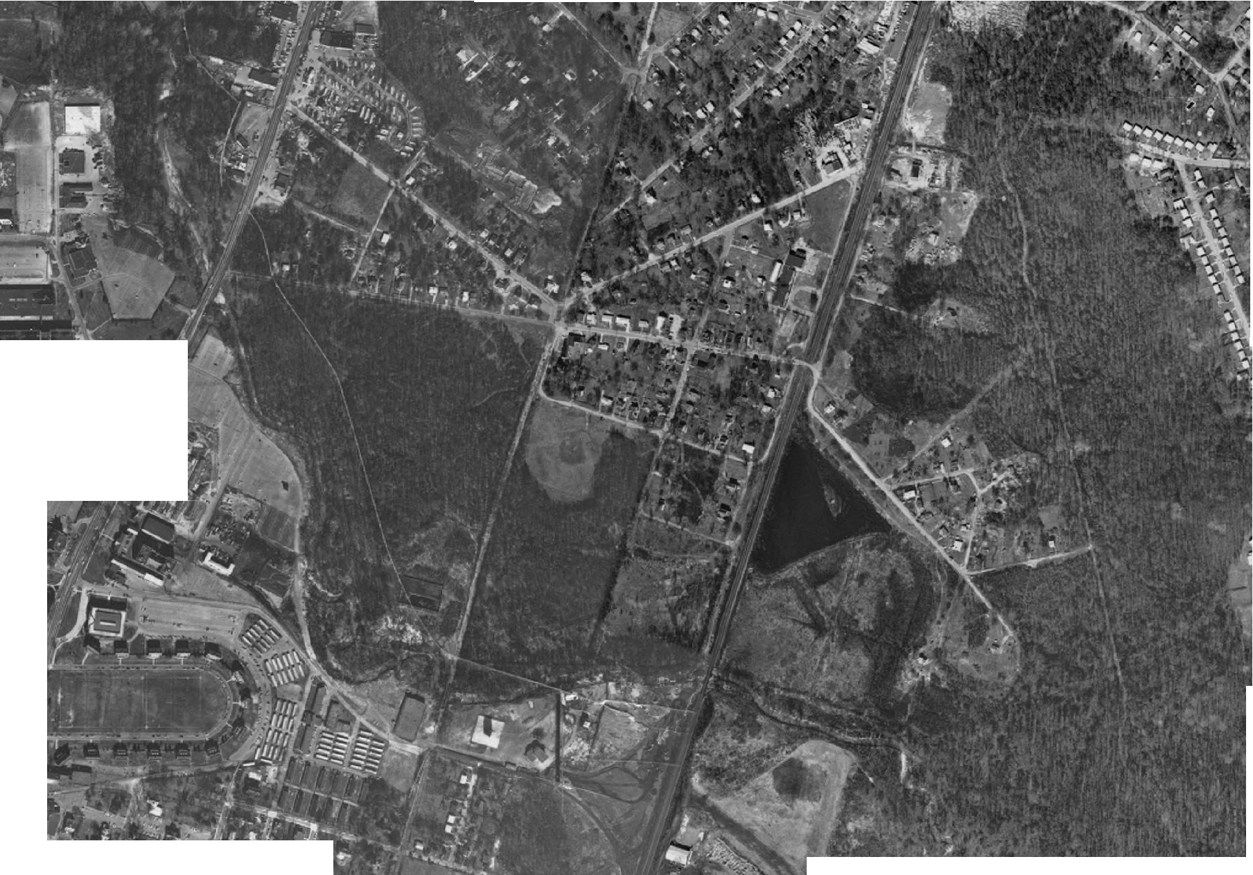
Lakeland Surrounding Area
1970
Aerial Image
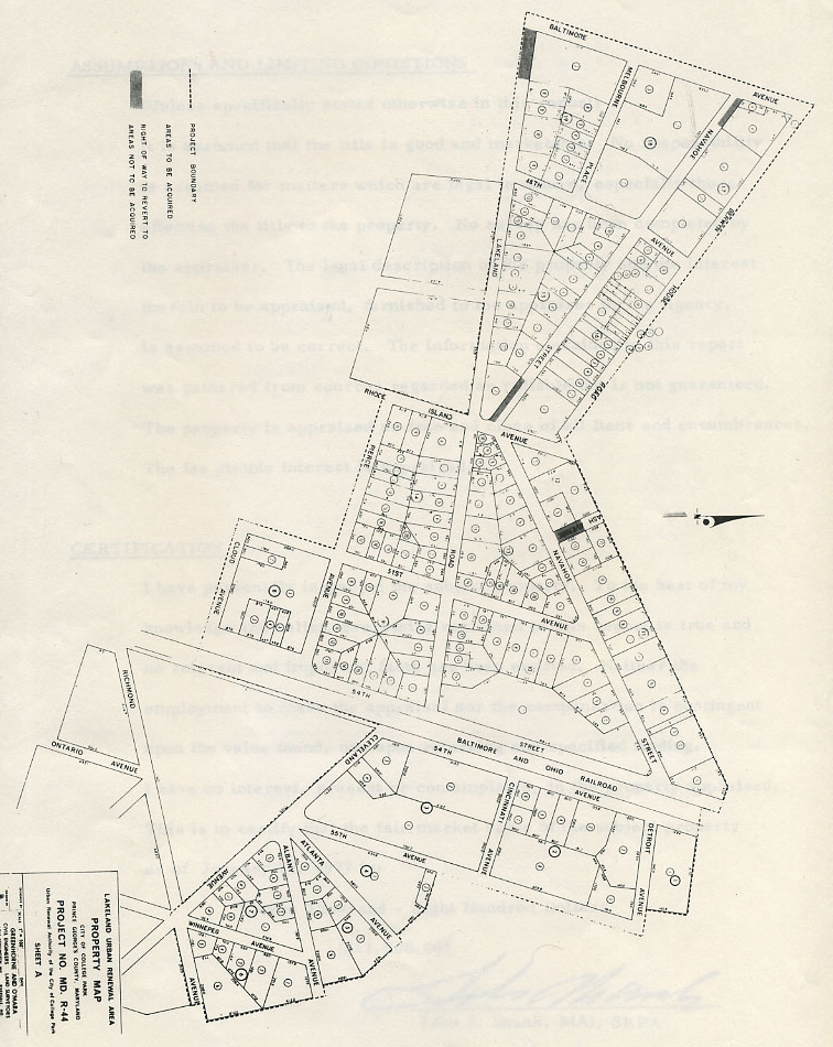
At Time of Urban Renewal
1978
Map of the Lakeland community just prior to implementation of the urban renewal program. The map also shows plots to be re-developed.
Eastern Lakeland
2015
Historic Map and 2000s overlay Work of UMD students