Type: Mapspage 1
Sanborn Fire Insurance Map, Close-up
Shows close-up image of 1939 Sanborn Fire Insurance Map including structural building details for block 12 lots 1-3 & 15. S = store D = dwelling 1 = 1-story; 2 = 2-story X on walls = windows 8 = 8" wall; 10 = 10" wall

Block 45 Lot 6 5400 Cleveland Avenue
Edwin A. Newman and Clara Newman originally purchased the property located at 5400 Cleveland Avenue on Block 45-Lot 6.�� The property was transferred to Enos Newman on November 19, 1894.�� Seven Years later, in 1901, Enos Newman of Rippen Hanover, Montgomery Pennsylvania, transfers the deed to Bessie Newman. In 1935 the property was ���taken from� Bessie Newman by the County Commissioner. On January 20, 1942, Cuban-born Marcelino Cordove of 1226 Girard Street, NW, Washington, DC, was granted the property.�� Macelino Cordove, age 55, apparently purchased the property for $12,500.00 (1930 U.S. Census).�� Marcelino is listed as ���Head of Household� and lives with his wife, Mary F. Cordove who is 53 years old.�� Their two daughters, Terisa, 27, and Evelyn Brown, 35, son Marcell, 25, and grandson Raymond, 14, also lived in the home listed on Girard Street (1930 U.S. Census).�� So far there is no record that all family members moved to the residence on Cleveland Avenue on the east side of Lakeland. According to an oral history, sited in the Lakeland Community Heritage Project's book ���Images of America Lakeland African Americans in College Park,� the house was used by Marcelino Cordove as a family operated lodging business with modest ���tourist homes� located adjacent to the house. The 1930 U.S. Census lists Mr. Cordove and his wife�۪s race as Negro.�� However, other documents list his wife as white (1900 U.S. Census).�� On March 3rd 1951 Marcelino Cordove transferred the deed to his relative Alexander S.C. Stant of 1627 Lamont Street, NW, Washington, D.C. for $10.00.�� Also on that same day records indicate that the deed was transferred back over to Marcelino Cordove and Alberta C. Cordove. (www.mdlandrec.net) In 1971, records show that Alberta C. Cordove relinquished the deed to Paul Parker, Jr. and Dolores E. Parker, C.W. Blomquist, Trustee, Diane K. Blomquist (Prince George�۪s County) and the Washington Suburban Sanitary Commission.�� However, records indicate that on January 15th 1971 Alverta (Cordove) received an inheritance of the property from Marcelino Cordove (d. 10/23/71). Six years later on January 25, 1977, Paul Parker, Jr. and Delores E. Parker transferred the property to the City of College Park. The property was subsequently condemned. As of September 20, 1990, Prince George�۪s County lists the property under the City of College Park, Maryland, Metro Book/Liber Number 7782, Folio 36. Please note the following quoted from Prince George�۪s County, Maryland record; ���I went through all the Grantee records for the County Commissioner hoping to find the deed, which gave them ownership of the property, but I couldn�۪t find it.�� It is also not clear to me if the County Commissioner purchased the land or just received it because no one purchased it at auction.�� ~ Margaret Prest� (www.mdlandrec.net)
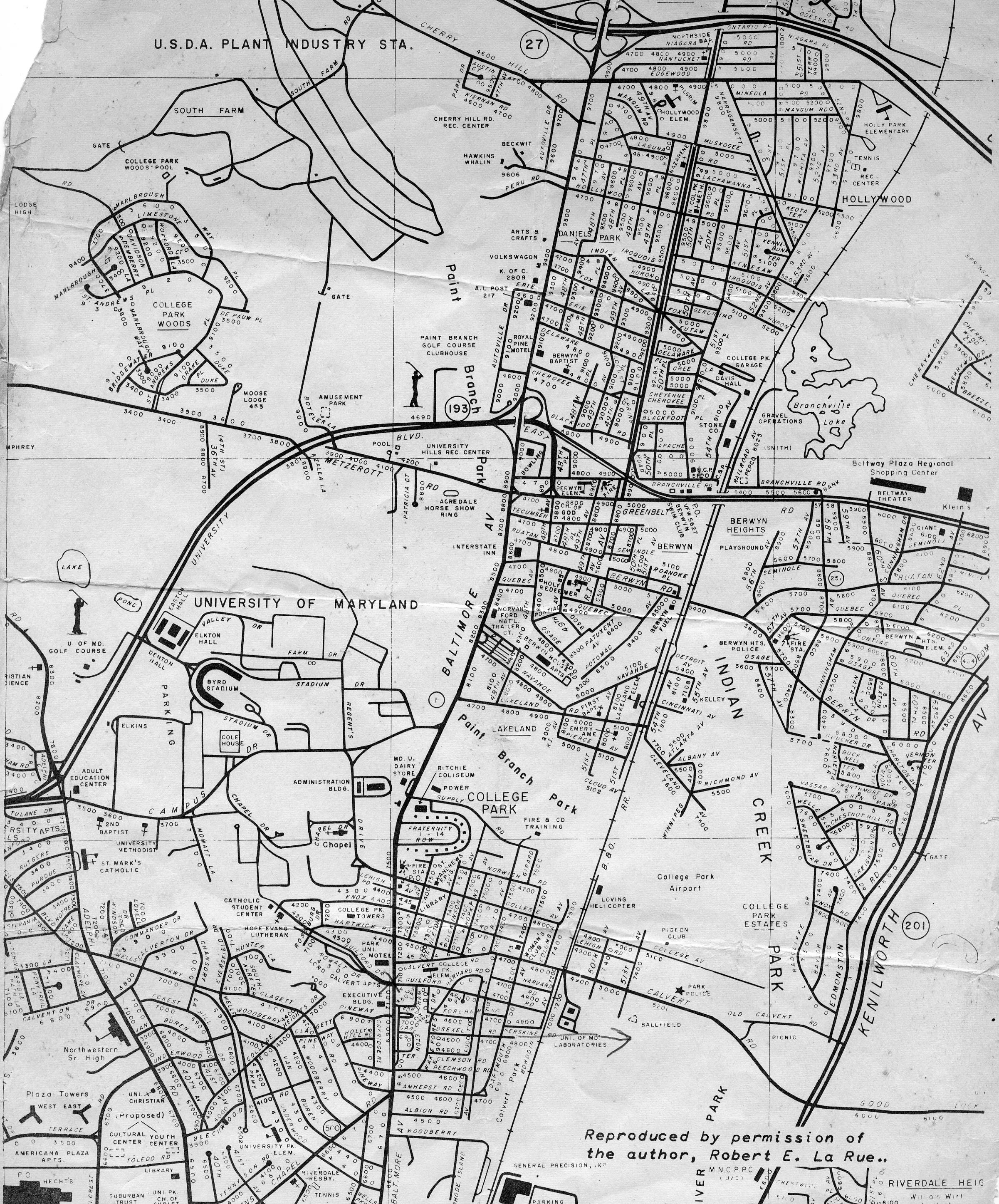

Map with Notes
This map shows notations on owners of properties
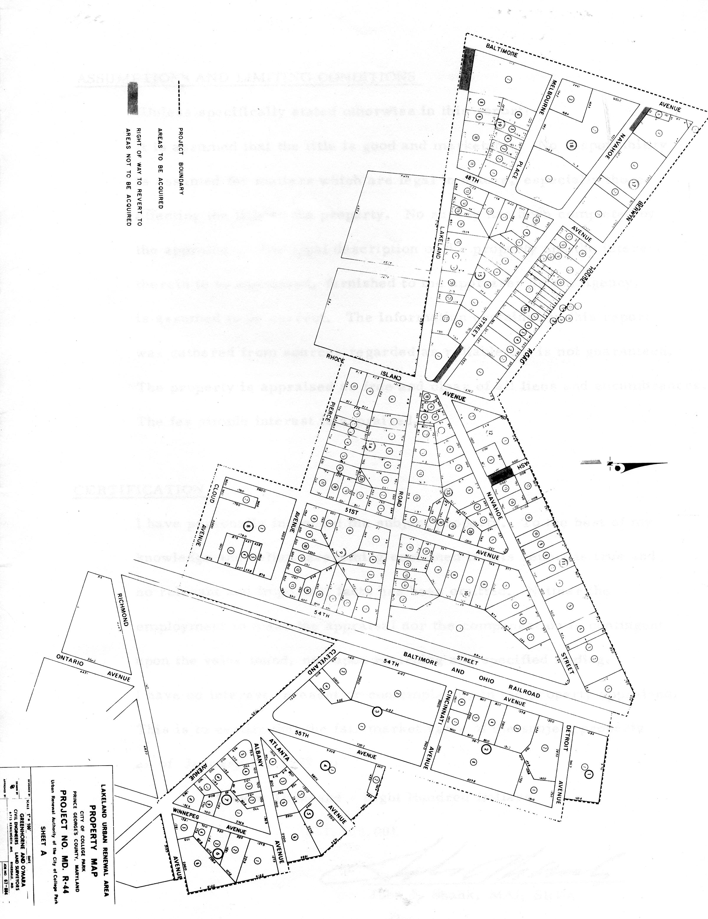
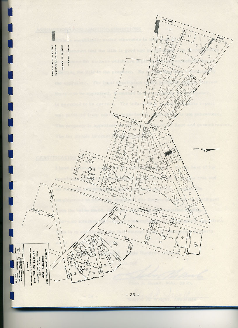
Property Map
Urban Renewal Property Map
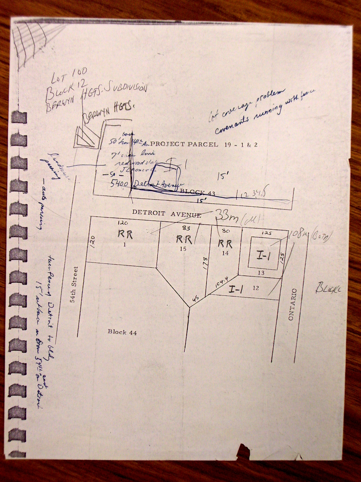
Plat of Project Parcel 19 - 1 & 2 hand written notations
Weygandt property
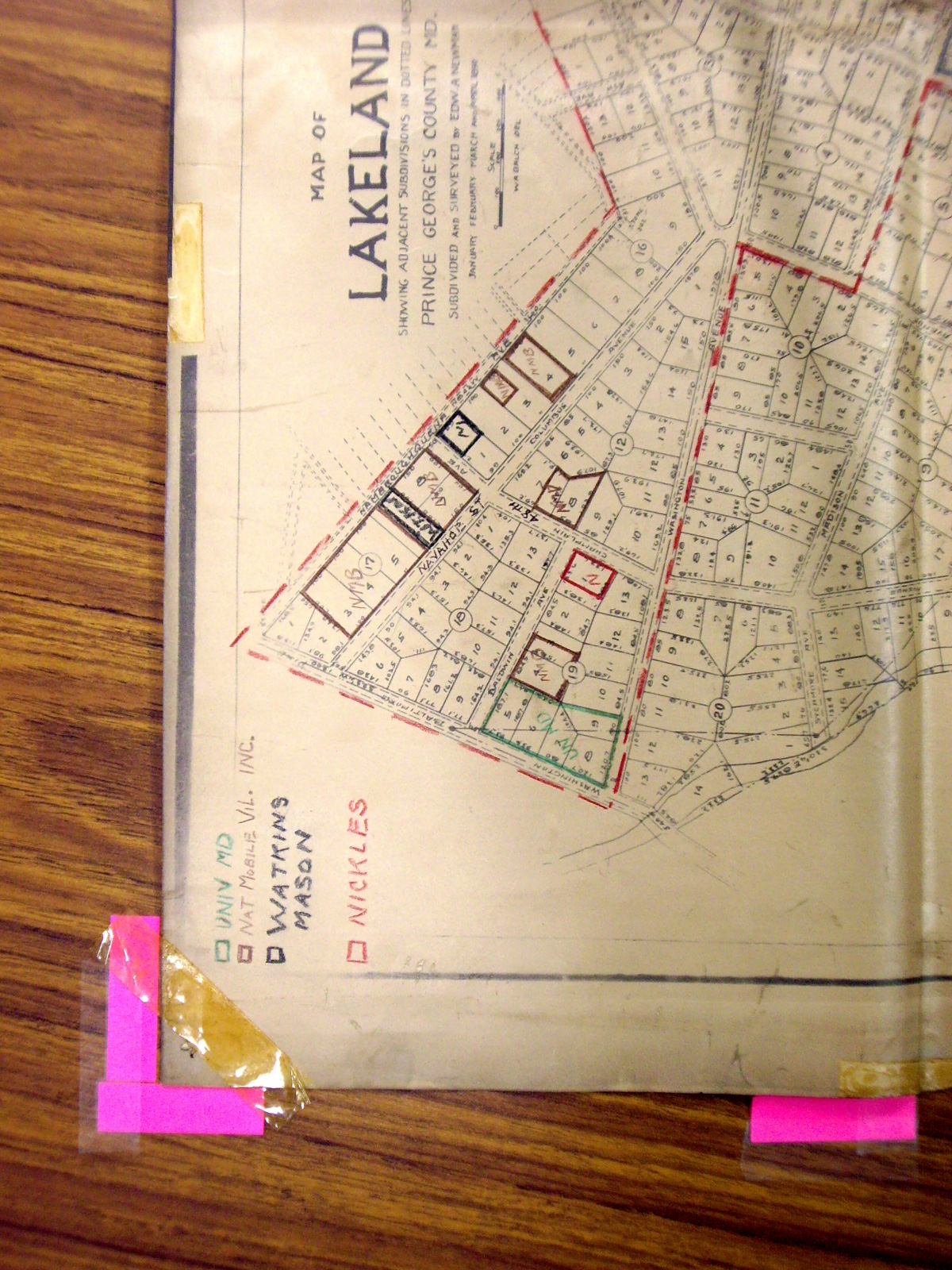
Color Coded Map Section
Appears to show location and ownership of subject lots within Lakeland 3 of 4
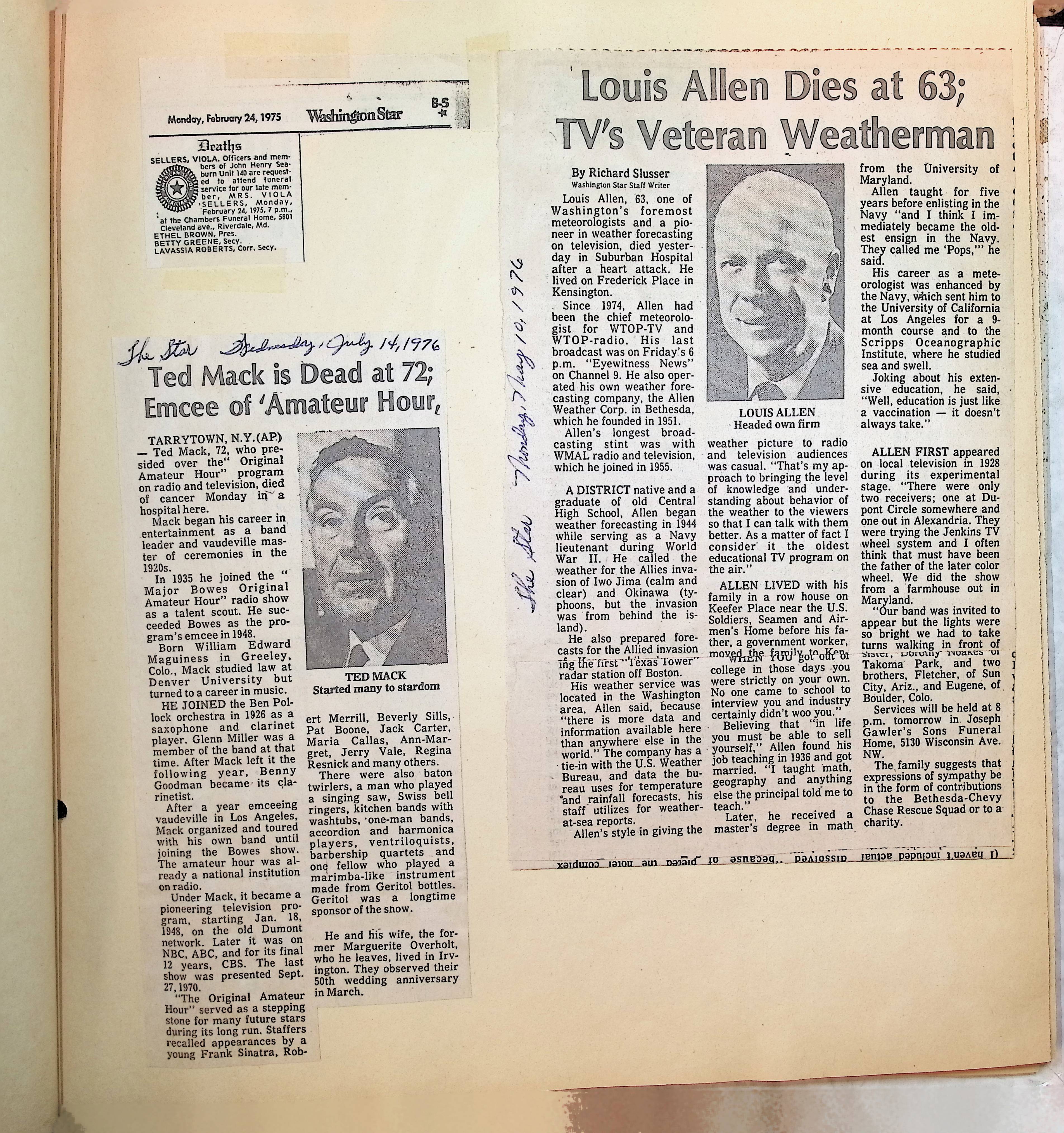
Lakeland Plan
Plat of property lines in Lakeland showing developer Edwin Newman's grand plan for his new subdivision.

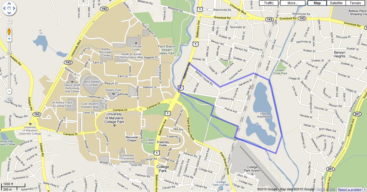
Map of Lake Artemesia
Prince George's County Atlas on-line map of Lake Artemesia. Named for developer, Edwin Newman's wife. It is an interesting triangular shape that can be recognized from original aerial photographs or any maps from Prince George's County, Maryland.
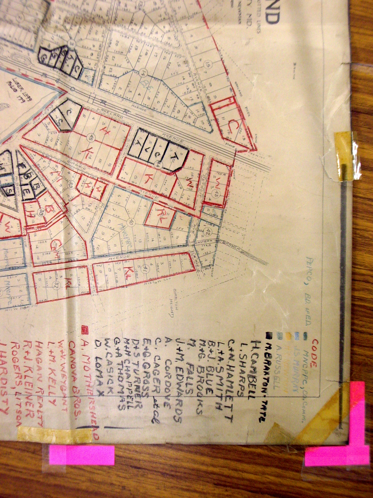
Map Section
Section of Lakeland map with hand drawn makings and color coding with names - section 1 of Appears to show location and of ownership of lots within Lakeland
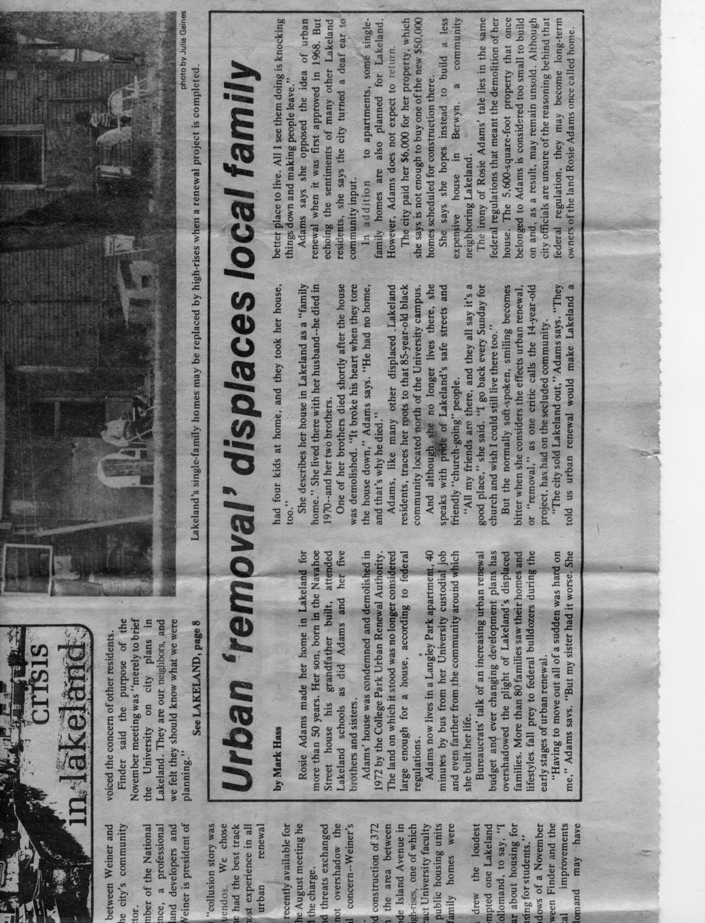
Section of Lakeland map with hand drawn markings and color coding - section 2 of 4
Appears to show location and ownership of subject lots within Lakeland
1939 Sanborn Fire Insurance Map, Close-up Block 12
Shows close-up image of 1939 Sanborn Fire Insurance Map including structural building details. S = store D = dwelling 1 = 1-story; 2 = 2-story X on walls = windows 8 = 8" wall; 10 = 10" wall

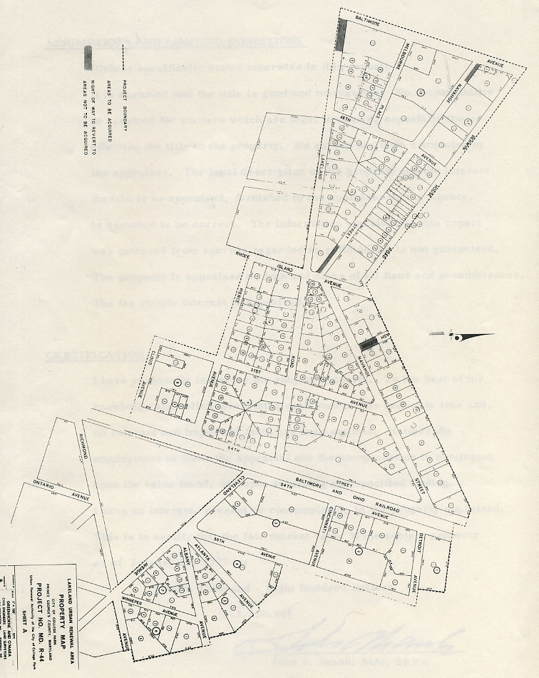

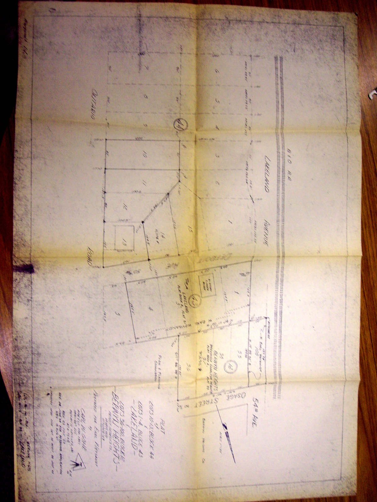
Plat of Lots 10,-14 Block 44 and lots 1-4 block 43
Plat of Lots 10,-14 Block 44 and lots 1-4 block 43

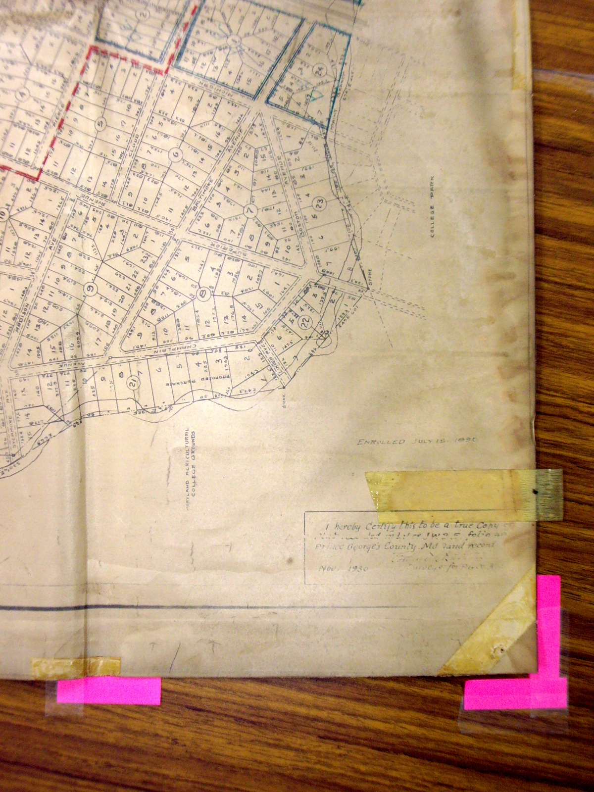
Section of Lakeland map
Hand marked map showing location and ownership of subject lots within Lakeland

1939 Sanborn Fire Insurance Map, Close-up Block 12
Shows close-up image of 1939 Sanborn Fire Insurance Map including structural building details. S = store D = dwelling 1 = 1-story; 2 = 2-story X on walls = windows 8 = 8" wall; 10 = 10" wall
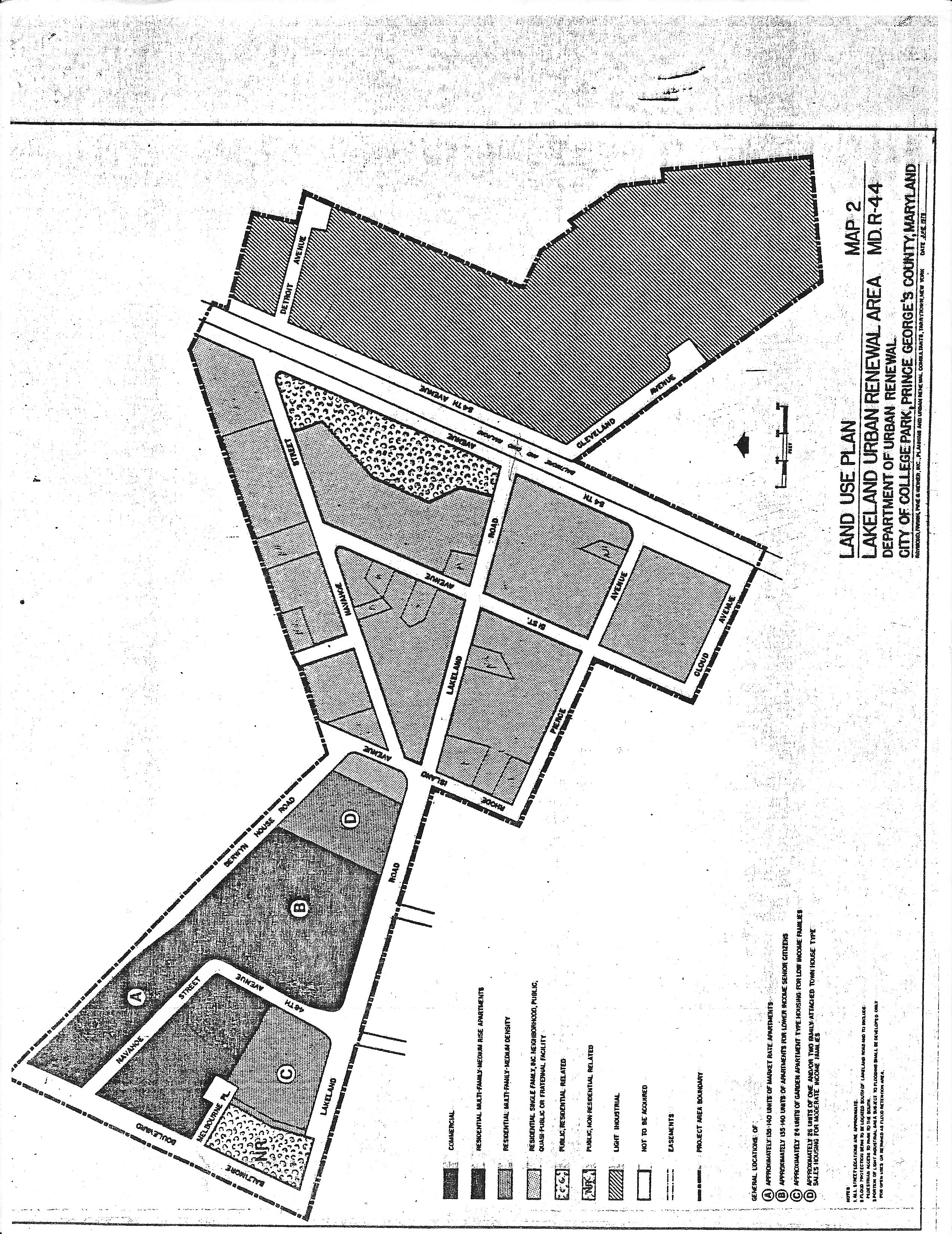
June 1978
Map 2
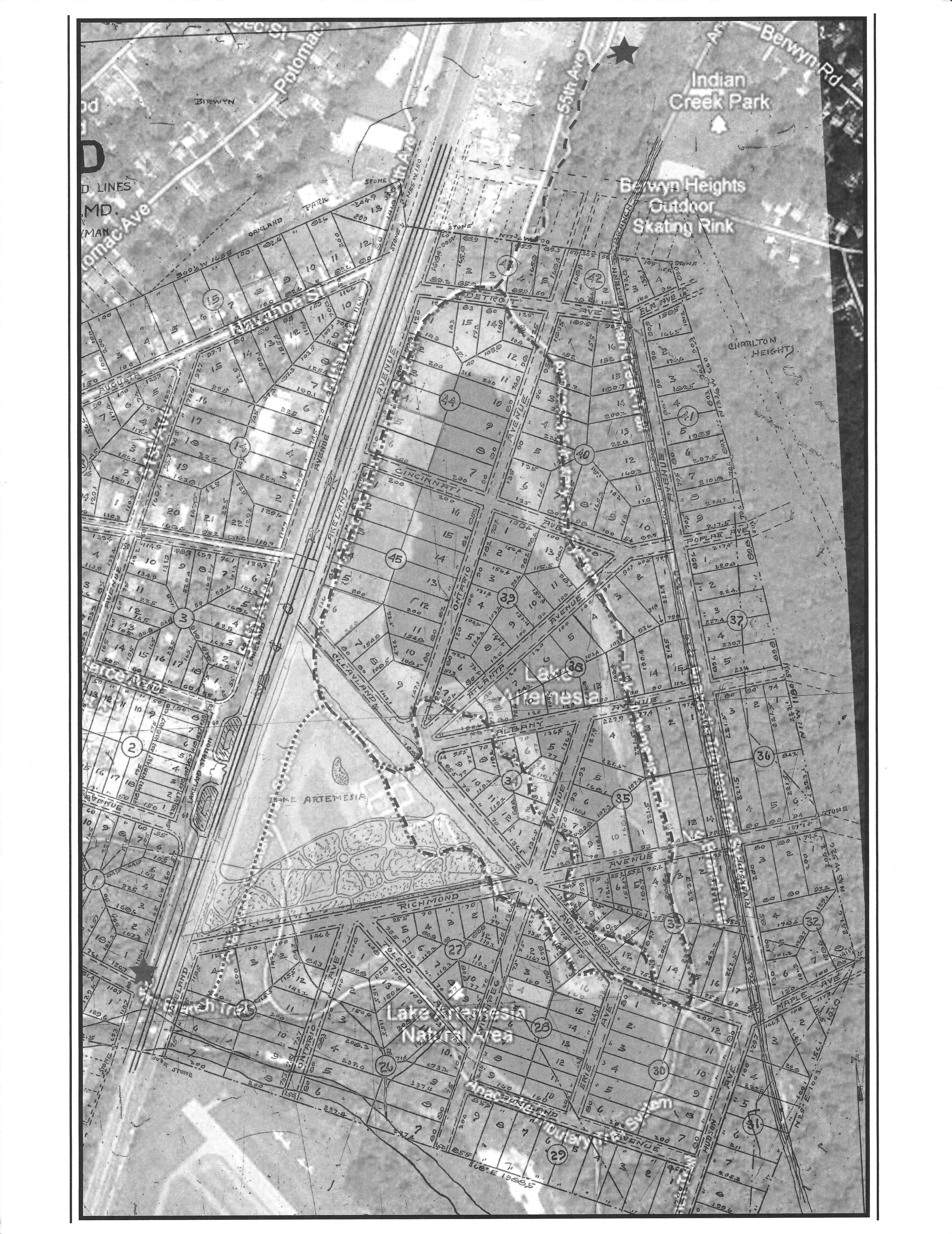
Eastern Lakeland
Historic Map and 2000s overlay Work of UMD students

Lakeland an Urban Design Study
"Lakeland, an Urban Design Sturdy" Commissioned by the City of College Park

Land Use Map
Land use map at time of urban renewal. Map taken from Lakeland an Urban Design Study for the City of College Park
How railroads, highways and other manmade lines racially divide America's cities
Washington Post July 16, 2015 Emily Badger and Darla Cameron Railroad tracks and other physical barriers were often used to separate Black and white communities. In many cases these divides remain today. Segregation was build into the physical fabric of cities. Examples of this are explored in Milwaukee, Washington, DC, Detroit, Buffalo, St. Louis. Kansas City, Mo., Tampa, Shreveport , Hartford, and Pittsburgh.
United States Aviation Field, College Park
Showing Proposed Enlargement To 1,030 Acres- Exhibit to House Bill No. 27502 and Senate Bill No. 8108 Third Session 62nd Congress “A field of level land two & one half miles long and three-fourths of a mile wide, seven miles from the Capital building on the main line of the Baltimore & Ohio Railroad between Washington and Baltimore. Four stations with sidings fronting on the property viz. Riverdale, College Park, Lakeland and Berwyn Electric railways and boulevards direct to Washington bordering the field on both sides” Third Session of 62nd Congress = 1912-1913
Baltimore and Ohio Railroad Facilities Survey showing Lakeland
Includes details of facilities on train line. Covers Lakeland, Berwyn, Branchville, and Daniel’s Park. Shown are indicators of a water tower near the lake and station signs between Cloud Avenue and Pierce Avenue. The map also lists acquisition information for railroad property. Lakeland is shown along with the location’s mileage designation, 1149+657 and is marked Lakeland Platforms, other notations include Berwyn Station, and Branchville Station.
Baltimore and Ohio Railroad Facilities Survey
District 16, Hyattsville
Baltimore and Ohio Railroad Facilities Survey, College Park Area
Gives facilities and land acquisition information for Riverdale, Hyattsville, and College Park. Other information is given including identification of buildings and names of property owners for land adjacent to railroad land.
Baltimore and Ohio Railroad Facilities Survey - Lakeland area
Gives facilities and land acquisition information for Lakeland, Berwyn, Branchville . Other information is given including identification of buildings and names of property owners for land adjacent to railroad land. Map shows changes in street names, the addition of an area next to Lakeland called Paint Branch and Lakeland Platforms does not appear on the map. A listing of facility changes is also given. Notations s show a “Fish House” adjacent to the rail lane at the location of “fish platforms”. The platforms were retired in 1931. This is a revision to the 1918 survey and contains a notations on property transfers for each area beginning with the company's acquisition of the property noted.
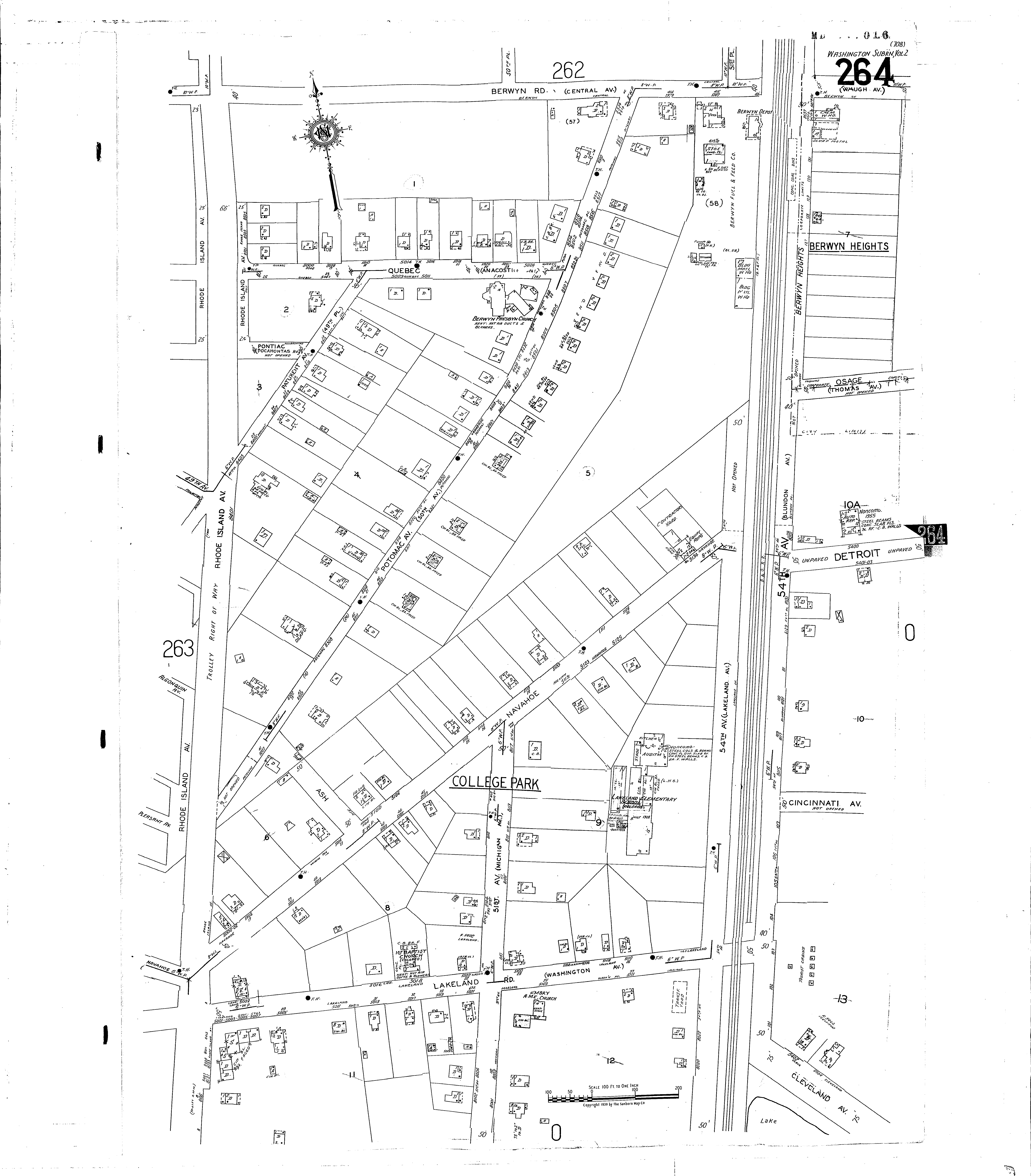
Sanborn Map
Suburban Map Company Volume Two, Prince George's County, Maryland Shows properties in Lakeland.

Tourist Cabins
Detail from 1939-59 Sanborn Company map Included in student research project
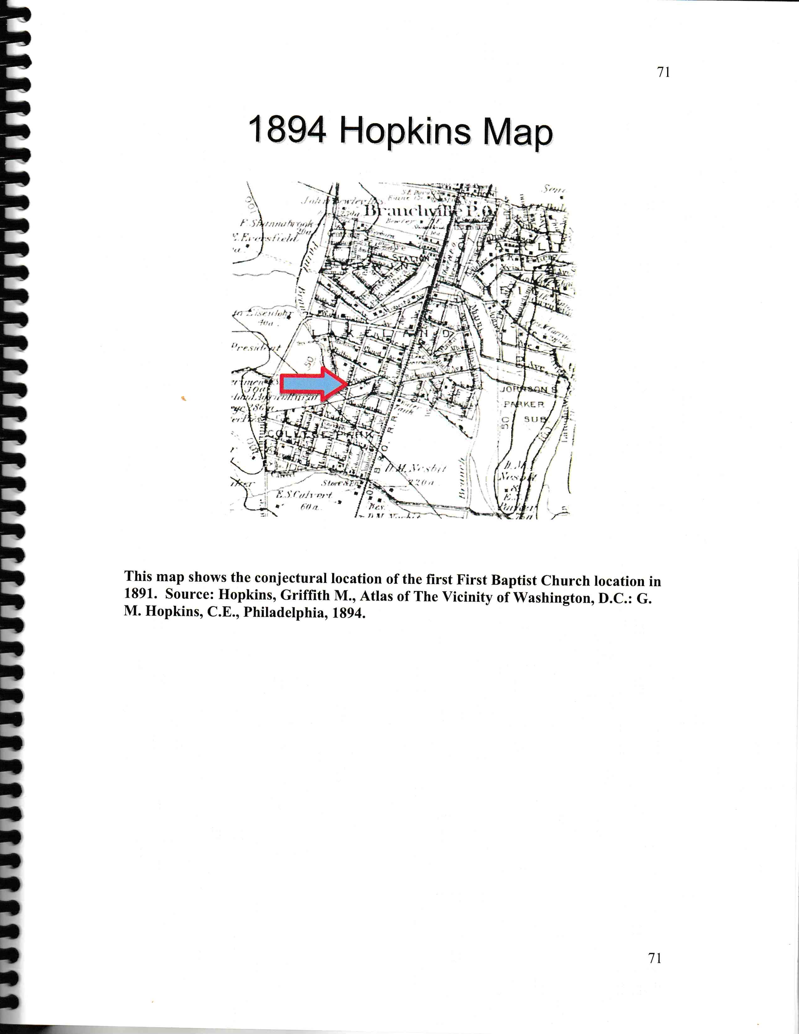
Hopkins Map Detail
Conjunctural location of first location of First Baptist Church on Hopkins Atlas
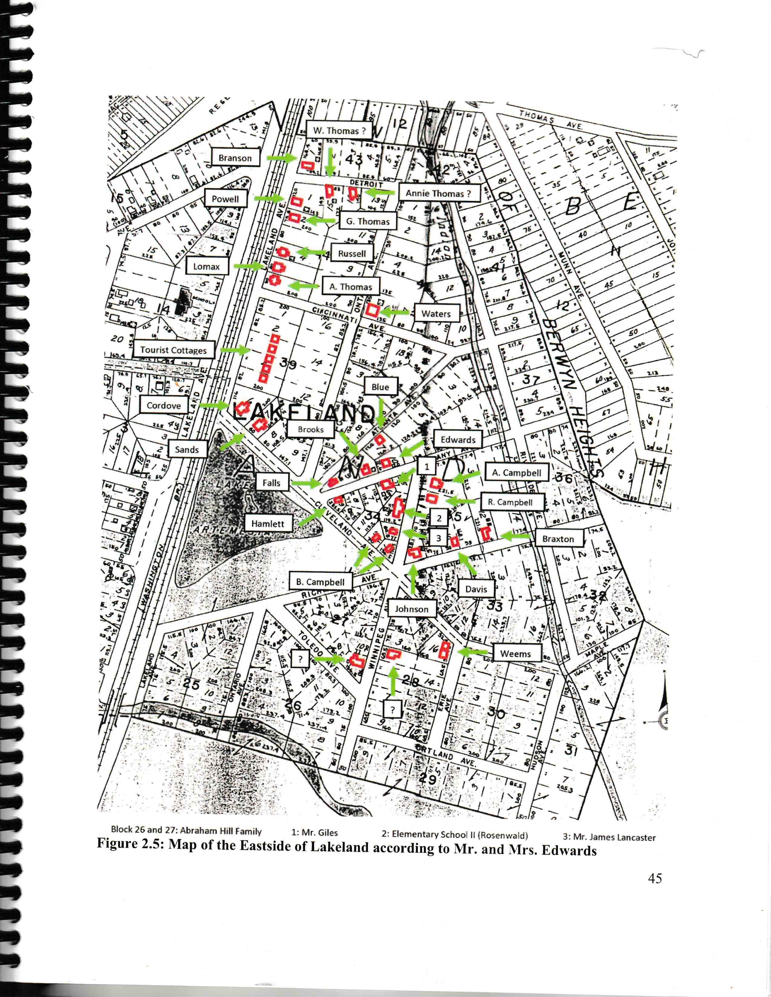
Eastern Lakeland Residents
Map of residences in eastern section of Lakeland based on information from Pearl Lee and James Edwards III Page from eastern Lakeland report
Lakeland Map
Item held by Harry Braxton, Sr. The map is affixed to a wooden board and covered with varnish.
Fish Breeding Ponds Under Construction at Lakeland, Maryland
By the Aquarium Fisheries Company of Prince George’s County MD
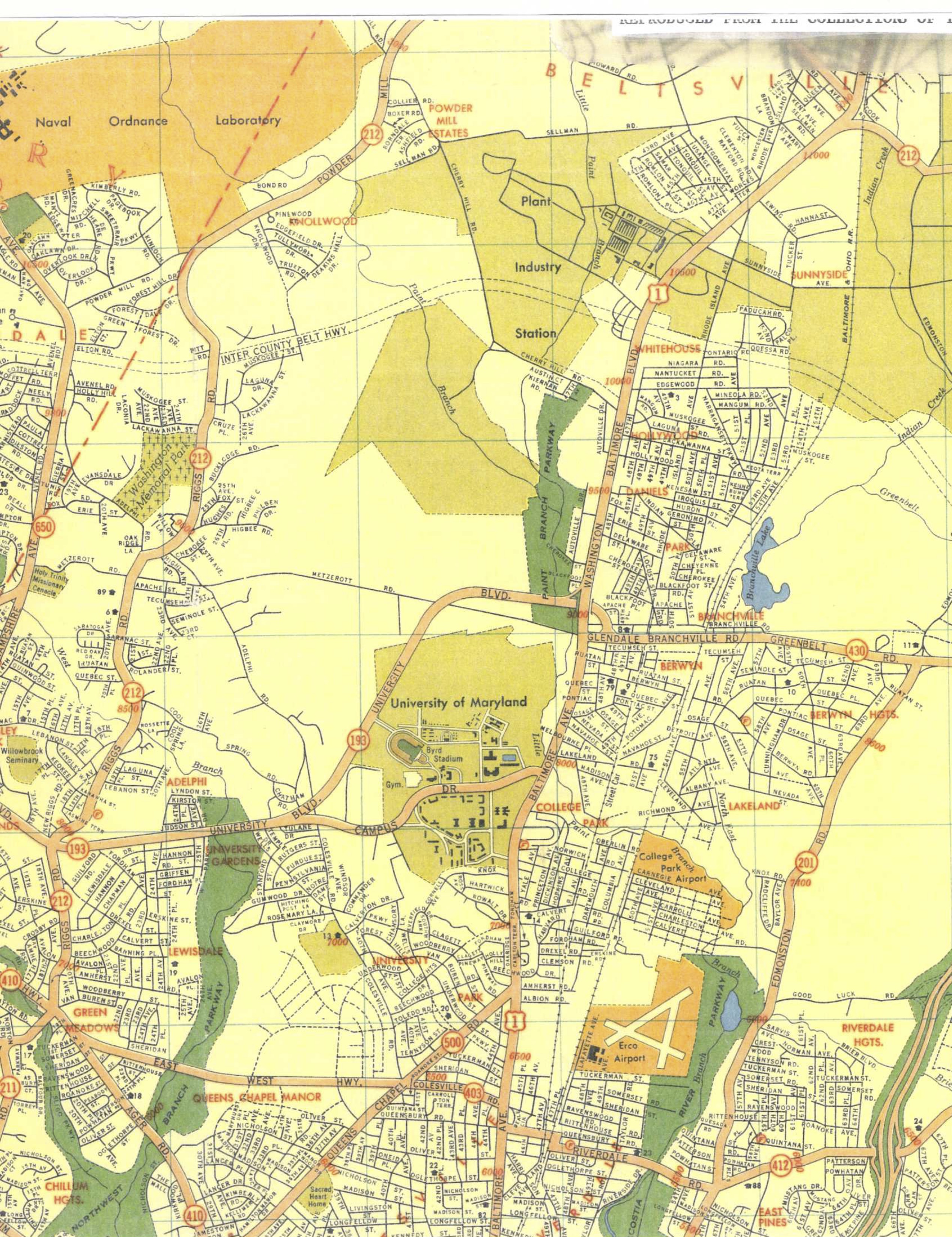
Zoning Map
College Park and area
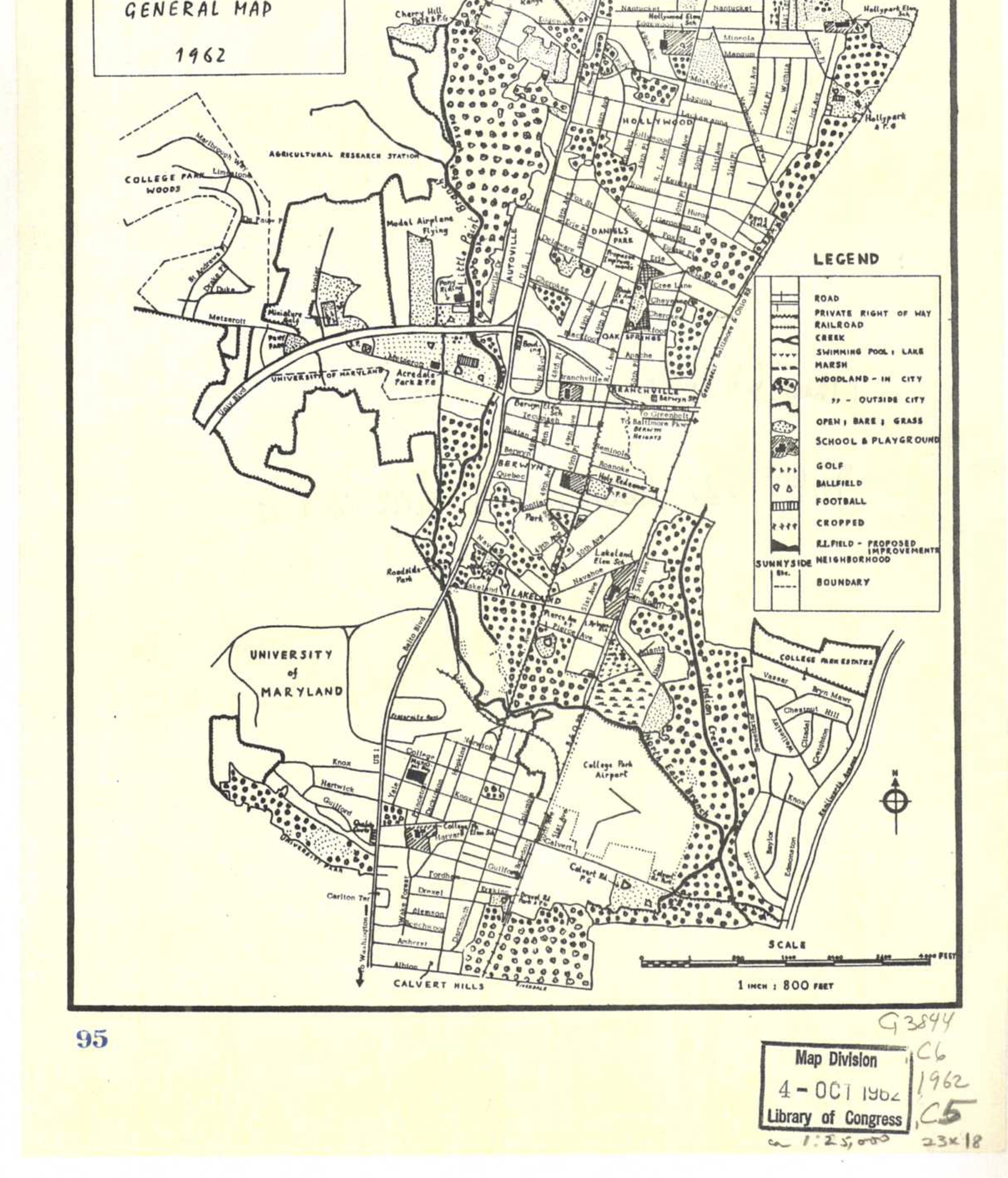

DC Suburbia Map
Map of DC Suburbia from Baltimore Ave to Rhode Island, 1939-1959
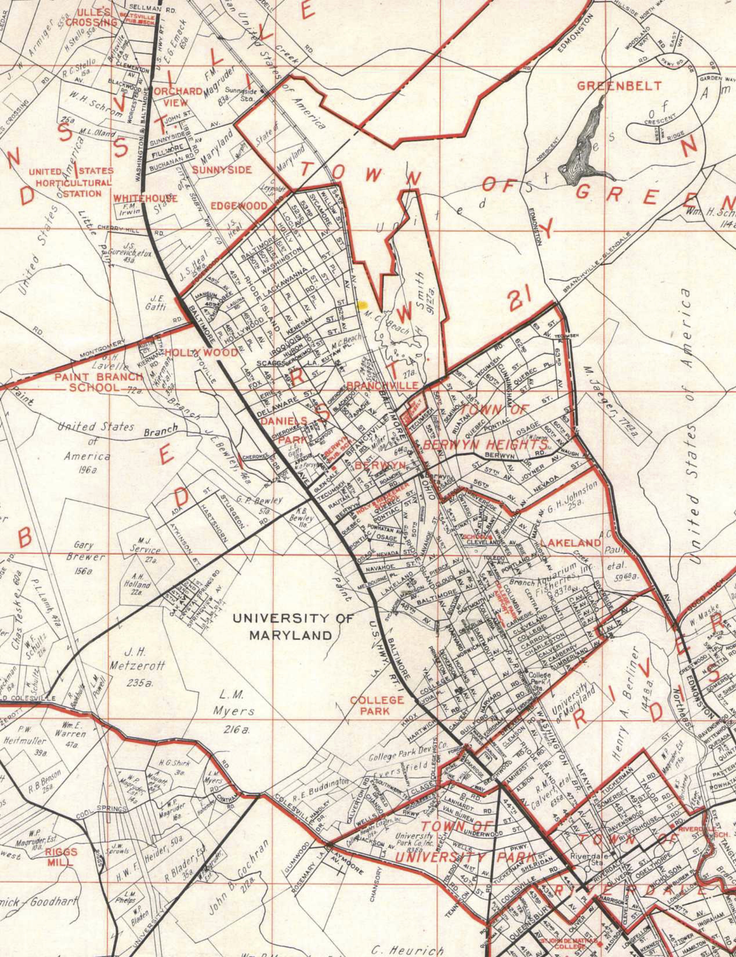
Franklin Survey
LaBue
